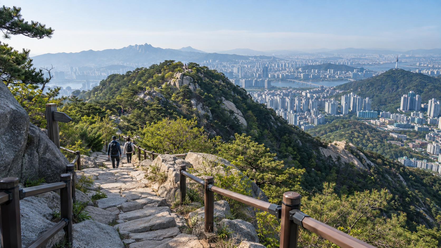
Mountains in South Korea are unusually accessible because mountainous terrain lies close to dense cities, public transportation reaches many trailheads, and public agencies maintain popular routes with signs, stairs, location markers and rescue systems. Their wooded appearance is also the result of major postwar reforestation, not simply untouched nature.
| Factor | How it improves access |
|---|---|
| Geography | Mountains rise beside many cities and towns |
| Transit | Buses and subways reach numerous trailheads |
| Trail infrastructure | Signs, stairs and route markers reduce uncertainty |
| Reforestation | Restored forests made mountains safer and more attractive |
| Rescue systems | Location markers help hikers report emergencies |
Why are mountains so close to Korean cities?
Much of the peninsula is mountainous, so urban development often fills valleys and flatter corridors rather than spreading evenly. This produces a striking pattern: dense apartment districts can end close to wooded slopes. In Seoul, several well-known mountains are reachable by subway and local bus.
How did reforestation change the landscape?
War, fuel gathering and erosion left many hillsides degraded in the mid-twentieth century. South Korea then carried out large-scale planting, forest management and erosion control. Today’s green mountains are therefore partly a public-policy achievement.
Why are Korean trails easy to use?
Popular routes often have directional signs, distance information, steps, railings, rest areas and numbered emergency markers. Public transit reduces the need to own a car or return to the same parking lot, making point-to-point hikes easier.
Is hiking in Korea always safe?
No mountain is risk-free. Weather changes quickly, rocks become slippery and crowded routes can create accidents. Infrastructure improves access but cannot replace appropriate shoes, water, weather checks and honest assessment of fitness.
Why is hiking culturally prominent?
Accessibility makes hiking an ordinary weekend activity rather than a specialist expedition. Clubs, families and coworkers can meet near a station, hike for several hours and return to restaurants and transit without extensive planning.
Are all Korean mountains equally accessible?
No. Urban mountains and famous parks usually have stronger transport and maintenance. Remote routes may require a car, careful navigation or greater experience. Trail conditions and closures should always be checked locally.
What an accessible mountain still asks of the city
Easy access can attract heavy use. A trail that begins near a residential district may need signs, maintained steps, drainage and regular attention to erosion. Those facilities make outdoor recreation more approachable, yet building too much infrastructure can disturb habitats or change the experience people came for. Managers have to balance visitor convenience, safety and conservation rather than simply maximize the number of paved paths.
Accessibility also has more than one meaning. A station close to a trailhead does not mean that every route is suitable for beginners, children or people with mobility limitations. Steep granite, wet steps, heat, ice and changing weather still matter. Before hiking, check an official park or local authority’s trail conditions, the expected difficulty, daylight and any closures. This is general planning guidance, not an assurance that a particular mountain or path is safe.
Why this is more than a hiking story
South Korea’s trails illustrate a distinctive public-space decision: natural landscapes near dense cities can function as everyday recreation rather than only remote tourist destinations. That result depends on transit, forest restoration and long-term maintenance. Compare how Seoul connects nature to daily urban life and why its transport connections work. The common theme is that convenience often looks spontaneous only after institutions have spent decades building it.
The numbers behind the green hillsides
The scale of the change is documented. According to Korea.net, drawing on Korea Forest Service material, nearly half of the country’s mountains were barren hills shortly after the Korean War, and the volume of standing timber was about 36 million cubic meters, the lowest since nationwide forest statistics began in 1927. Stronger reforestation and protection policies in the 1970s and 1980s, together with a shift from firewood to other household fuels, reversed the trend. The same source reports that forest stock per hectare rose from about 10 cubic meters in 1972 to about 165 in 2020, and that forests now cover roughly 63% of Korea’s land area, against a world average of about 31%.
These figures matter for hikers because they explain why a walk on a Seoul mountain today looks like established woodland rather than scrubby slope. Korea’s reforestation records were also registered in UNESCO’s Memory of the World programme in 2025, according to the same report. Recovered forest made slopes more stable and more pleasant to use, which in turn raised public demand for trails and access.
A closer look: Bukhansan National Park
Seoul’s official travel guide describes Bukhansan National Park as the only national park in the Seoul metropolitan area, with free admission and entrances reached by subway and bus. For example, one route runs from Gwanghwamun Station on Subway Line 5 to the park entrance by bus. The Dobong entrance can be reached from Dobongsan Station, on Subway Lines 1 and 7, on foot. Bukhansan became a national park in 1983 and covers both Bukhansan and Dobongsan.
Easy access has a cost. According to Aju Press, citing Korea National Park Service data, Bukhansan had about 7.53 million visits in 2025, the most of any national park and 17.4% of all national park visits in Korea that year. A trail network that handles millions of visits needs constant repair of steps and drainage, which is exactly the maintenance burden discussed above.
Practical tips for a first Korean mountain hike
- Plan the whole journey. Check the subway and bus route to the trailhead, and the return route, before you leave.
- Check trail status. Some routes are closed temporarily for wildfire prevention, weather damage or habitat protection. Confirm with the park or local authority before you go.
- Start early. Popular mountains are busiest at weekends, and daylight can be shorter than expected in autumn and winter.
- Carry the basics. Water, a layer for the summit, a charged phone and shoes with grip matter even on a well-marked route.
- Use the markers. Numbered location markers along routes help rescuers find you quickly if you need help.
FAQ
Can you hike from the Seoul subway?
Yes. Many trailheads are reachable by subway plus a short walk or local bus, though the exact route should be checked before departure.
Why do Korean mountains have so many stairs?
Stairs control erosion and help people climb steep, heavily used sections, although some hikers find them tiring.
Did Korea’s forests recover naturally?
Natural regrowth helped, but national reforestation, fuel-policy changes and long-term forest management were central.
A public landscape close to everyday life
Korea’s mountain access is the product of geography, density and institutions working together. The mountain at the end of a subway line feels natural, but the ease of reaching and using it was built over decades.
Sources and further reading
- Korea.net: Reforestation creates a green miracle
- Korea Development Institute: Forest Resource Development in Korea
- National Fire Agency: Mountain rescue cases and safety measures
- Visit Seoul: Bukhansan National Park
- Aju Press: More South Koreans flock to national parks, with Mt. Bukhansan most visited (Feb 2026)